WINSDK – is a tool for developing office mapping applications
Library for the development of office applications, enabling to display the map in a specified area of the screen, calculate the route of the object motion in an optimum manner, quickly find the object based on the address, send the planned route to the driver, send him/her messages and receive messages in reply, including the voice ones. Thanks to unique route calculation algorithm, taking into account statistics and traffic jams, the route is calculated in the flicker of a second for several vehicles at once. Regular updating of the map collection will keep your maps updated.
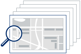
Wide variaty of maps for different tasks
The library offers at once several collections of maps for work. Choose between licensed maps from well-known manufacturers or use free maps being created by the OpenStreetMap community.
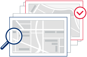
The real thing will definitelly be found
Our maps contain information not only about streets and houses. With convenient and quick search you will be able to find quite the thing on the map, and then calculate the distance along the route and transfer it to the driver. Sights, hotels, restaurants, shops and many other things – a database of places of interest (POI) knows what is located and where it is.
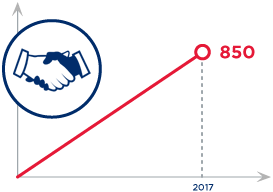
Our clients and partners
As of the beginning of 2017, more than 850 transportation and logistics companies have benefited from the advantages and service of CityGUIDE SDK.
Communication module COM.LIB (IMessageSdk)
The solution includes communication library COM.LIB which is shiped as dedicated module (win lib .dll) contains of various COM-objects. Library is used fof communication between in-car mobile navigational app CityGUIDE (v. 8 or higher) and corporate fleet management solution to support geocoordinates exchange, routes and orders assignment, communication by text or even voice.
Main features
- Message exchange between office and mobile app (CityGUIDE v.8 or higher);
- Vehichle on-line monitoring (speed, coordinates, route);
- Route points information exchange (coordinates, address, ETA);
- Fleet monitoring;
- No special corporate mobile-app required;
- Remote assignment of route points for vehicle.
Easy solution for logistics and traffic control
- Usage of real traffic situation (information on traffic jams) from the servers of the CityGUIDE navigation service (for CityGUIDE maps).
- A unique algorithm for calculating the route will suggest a route with consideration for traffic jams (for CityGUIDE maps) and accurately predict the time of arrival to the point of destination. If desired, it is possible to correct the route from the control room.
- You can map any of your own objects and provide them with comments.
- Regular (daily for some maps) updates of revisions for CityGUIDE maps (information on changing of signs, closing and opening of streets, etc.) and for other map collections.
Documentation
All the functionality is described in detail in the SDK manual. Please contact us to get a demo version.
COM.LIB user's manual available only in russian language. Please feel free to contact us for english version.